Detecting Phantom Coverage: How Starlink Can Win Over Frustrated Mobile Users
Phantom coverage occurs when a carrier’s map shows service in a location but users still experience weak signal, slow data, or dropped calls. This guide explores how Starlink can identify and solve these gaps to win over dissatisfied mobile customers.
What Is “Phantom Coverage”?
Comparison of Coverage: Verizon, AT&T, T-Mobile, Dish, & US Cellular
In the rapidly evolving world of mobile connectivity, choosing the right network provider can be daunting. With giants like Verizon, AT&T, T-Mobile, Dish, and US Cellular vying for your attention, understanding their strengths and weaknesses is crucial. This article offers an in-depth comparison of these top providers' network coverage, drawing insights from CoverageMap.com and encouraging users to validate these findings with the SpeedSmart app.
What State Has the Worst Cell Phone Coverage? A Comprehensive Analysis
In today's digital age, staying connected through our cell phones has become a necessity. Whether for work, social interactions, or emergencies, reliable cell phone coverage is crucial. However, not all states in the United States offer the same level of service. In this article and video, we will conduct a comprehensive analysis to identify the state with the worst cell phone coverage, exploring the factors contributing to its challenges and offering insights for users in that region.
Why Cell Phone Coverage in National Parks Can Be Bad & How to Improve Reception Problems
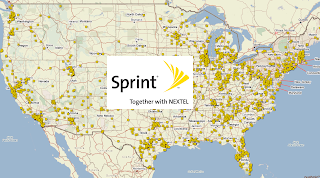
Sprint Service Plans and Coverage Review
 Coverage: Sprint, which is now part of T-Mobile, was a major wireless service provider in the United States. While the Sprint brand has been phased out, customers are now under the T-Mobile network and plans. Here is a review of T-Mobile's service plans and coverage, which now encompass former Sprint customers:
- T-Mobile Service Plans and Coverage Review
- Verizon Wireless Service Plans and Coverage Review
- AT&T Wireless Service Plans and Coverage Review
@SprintCare Twitter Chatter
Tweets about @sprintcare
AT&T Service Plans and Coverage Review
AT&T is one of the largest wireless service providers in the United States, offering a variety of service plans and extensive coverage across the country. Here is a review of AT&T's service plans and coverage:
- T-Mobile Service Plans and Coverage Review
- Verizon Wireless Service Plans and Coverage Review
- Sprint Wireless Service Plans and Coverage Review
@ATTCares Twitter Chatter
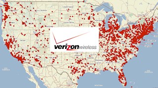
Verizon Wireless Plans and Coverage Review
Finding the best cell phone coverage just got easier by comparing cell phone coverage reports from other customers. Which wireless carrier has the worst cell phone coverage?
- T-Mobile Service Plans and Coverage Review
- AT&T Wireless Service Plans and Coverage Review
- Sprint Wireless Service Plans and Coverage Review
@VZWSupport Twitter Chatter
Tweets about @vzwsupport
Cell Coverage in Yosemite National Park
Yosemite National Park, located in California, is known for its stunning natural beauty and attracts a large number of visitors each year. However, due to the park's remote and rugged terrain, cellular coverage can be limited or unavailable in certain areas. Here's some information regarding cell coverage in Yosemite National Park:
Cell Coverage in Yellowstone National Park
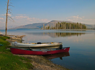
Yellowstone National Park, located primarily in Wyoming but extending into Montana and Idaho, is a vast and geographically diverse wilderness area known for its natural wonders, geysers, and wildlife. However, due to its remote location and rugged terrain, cellular coverage in Yellowstone National Park can be limited or unreliable. Here's some information regarding cell coverage in Yellowstone National Park:
Why Are The FCC Cell Phone Coverage Maps Gone?
When did the FCC shut down these maps and why? (Please comment below)
You were able to use the map to see how well cell phone service is in your area. They told you if you were able to see areas that have good reception and bad reception.
You could tell if a cell phone carrier has coverage in an area if you know the extent of their network. The FCC doesn't know where each carrier's towers are. Because of this, you won't be able to compare two different carrier's coverage on the map.
The data for the map is generated by testing cell phones over a period of time and seeing what signals they get. This means that it will not predict how well future devices will work. There could be new towers that were built after the data was collected, or there could be more people using data than usual which causes phones to have trouble connecting to towers nearby. Also, radio waves travel poorly through buildings so there may not be as much signal indoors as you would think based on the outdoor measurements shown on the map.
You use to be able to find an address or zip code that you want information about using the search bar at https://www.fcc.gov/general/wireless-coverage-maps (page not found). The FCC has never been known to be very competent and it is not surprising that they have a new landing page and haven't redirected the old links. https://www.fcc.gov/BroadbandData/MobileMaps
Per the FCC "Other Mapping Improvements Are Coming" Last Update Friday, August 6, 2021
Once the Broadband Data Collection is fully implemented, the FCC’s broadband maps will include additional layers and functions. For fixed internet service, the maps will show – on a house-by-house, location-by-location basis – where broadband internet access service is available, meaning that it has a broadband connection or could be connected within 10 business days with a standard installation. The FCC will standardize location data through the use of a Broadband Serviceable Location Fabric, a common dataset of all structures in the United States where mass-market fixed broadband internet access service can be installed.
The Broadband Data Collection maps will also incorporate systems and processes for the validation and verification of provider-submitted data to improve their accuracy, as well as a user-friendly challenge process that will allow consumers, state, local, and Tribal governments, and other third parties, to dispute the information shown on the maps.
We will provide updates as more information related to the full set of Broadband Data Collection systems and processes becomes available.
AT&T is the nation's second-largest cell phone carrier. Their interactive map lets you see coverage details for your area, and they offer three types of coverage: 5G, 4G LTE, 4G, 3G
If you're looking to stream any video content or play online games, your best bet is to make sure that there's 4G LTE coverage in your area. If that isn't an option (or if you're a T-Mobile customer), it's worth checking AT&T's website to see how strong their signal is. Your search will be much more fruitful in larger cities than rural areas.
The first thing you'll want to do is visit the Verizon coverage map.
Once there, you can enter up to 10 addresses at a time to see the level of voice, 3G, 4G, 5G and LTE coverage for that particular area.You'll also be able to check coverage for data and messaging if those are services that are important to you.A Verizon representative will also be able to offer guidance on international roaming options while in a foreign country.
This map shows T-Mobile’s 2G, 3G, 4G and 5G network coverage in the United States, including Puerto Rico and the U.S. Virgin Islands. You can search for a location or use your device's current location to find out if you're covered by T-Mobile's network. The map includes coverage for voice, text and data services as well as roaming (where available). *5G coverage not available everywhere; only available in limited locations with eligible devices and features.*
These maps can help you find cell phone coverage for your wireless carrier in an area where you might want to move, travel or do business in.
You can use these maps to find the cell phone coverage for your wireless carrier in an area where you might want to move, travel or do business. These maps are particularly useful for those planning business trips and vacations, as well as those looking for the best coverage when shopping for a new home or apartment. If you have been experiencing problems with your wireless service, these maps can help you determine if the problem is with your carrier or phone.
How Does Our "Worst Cell Phone Coverage" Page Fall From Top 10 to Top 60 in 1 day?
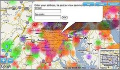
Consumer Generated Cell Phone Coverage Maps

How To Check For Cell Phone Coverage By Address
When it comes to choosing the best mobile operator, most people think of the Big Three. The Big Four are known as AT&T, Verizon, T-Mobile / Sprint. However, but they should also include a number of other smaller MVNO carriers that use these major networks.
All four networks are available in the US, with AT&T, Verizon, T-Mobile, Sprint each having their own LTE networks. According to paid studies most carriers will claim they have coverage everywhere but we know this is not true. Coverage only matters at your home address and the only way to check this is by asking someone else in your area, trying it out, or by looking at coverage complaints submitted by customers on the cell phone coverage reviews map above or on the check cell coverage by address mobile map.
You can search this map to see which areas have the worst overage on each of the four major networks in the United States. Use the small search circle in the lower left-hand corner of the map. This map allows you to filter coverage reviews of all major mobile networks by simply clicking on the carrier on the right-hand side of the map.
Enter your country, city, postal code, home or office address select your current location, filter by carrier type and region, and select the best and worst coverage in your area for each of the four major networks in the United States. In this example, you choose one of four different types of mobile towers for the USA and specify a country.
Use can other tools like RootMetrics, OpenSignal, CellReception.com, or SignalMap to see what others are reporting about the range of the operator in your area based on positive signal strength. However, these providers do not allow you to provide reviews on carriers in specific locations. There is also a map to look at cellular towers and antenna locations nearby.
RootMetrics does not have a map of the mobile towers in the viewfinder, but in some areas, it shows the cell signal quality. Although Root Metrics does not have a map of mobile towers, it is a strong indicator of signal quality in your area.
T-Mobile Tower Map lets you enter your zip code, locate a location on the map, and see if 4G LTE coverage is available. Search for T-Mobile 5G coverage from your current location, and it's available in all 50 states and Puerto Rico.
Sprint gives you the ability to look up any address you want and allows you to see the coverage that's in your location. To access the website you are using, such as T-Mobile Tower Map, first, enter your address in the search engine of our website. Go to our mobile phone comparison engine and check the coverage at your exact location, and you will begin to gain a better understanding of coverage at the sites you are using.
Compare Cell Phone Towers & Dead Zones Map
How to Compare Wireless Coverage
Can You Drive Testing Indoor Coverage?
Wireless service providers (especially in the U.S.) do drive testing to build theoretical coverage maps and test their networks for cell signal strength. Drive Testing or wireless data collection is used to provide coverage analysis, network weakness information and to aid in finding specific problem areas reported by consumers. Most drive testing companies are specifically tasked with simulating the actual call experience of customers during weekday periods to simulate capacity issues outdoors. Such companies include GWS, LCC, and WFI. Most carriers outsource this capability to third parties, unlike Verizon who has its own in-house drive testing team. Drive testing companies usually spend between $15-25 per mile in over 300+ U.S. markets benchmark testing signals. These companies provide a tremendous service to the carriers and deserve every penny for their efforts but how do they efficiently acquire in-building coverage data where customers use their phone the most?
DeadCellZones.com will be a the forefront of the carrier femtocell revolution and will start helping drive testing companies get better visibility of in-building coverage problem areas. U.S. carriers are starting to roll out femtocells and the number of worldwide subscribers is rising rapidly, jumping from 1.7 million in 2007 to 9.7 million in 2008. The number of femtocell phone units is expected to nearly quintuple in the 5 years from 2007 to 2011.
 I think the current recession is going to demand cost-cutting measures that we have never seen from these companies since churn is more prevalent than customer growth. The carnage could be huge from suppliers and vendors beneath the umbrella of these giant companies of those who do not innovate. Its widely known throughout the industry that working with carriers is not much different than working with government bureaucrats because of their proprietary networks and huge customer bases. The lack of leadership of the wireless communication giants to is the primary reason why the U.S. is way behind Europe and Asia in wireless telecommunications.
Joshua Tree National Park Has Zero Cell Coverage
Popular Posts
-
Boost Mobile Coverage Map Boost Mobile is a prepaid wireless service provider in the United States. It offers no-contract cell phone ...
-
As WiFi becomes more essential to modern homes, many people wonder how far a WiFi router should be from their sleeping area for safety and...
-
In the rapidly evolving world of mobile connectivity, choosing the right network provider can be daunting. With giants like Verizon, AT...
-
Which State Get The Most Cell Phone Coverage Complaints?
-
Experiencing full bars on your cell phone display but no service can be attributed to several factors:
-
AT&T is one of the largest wireless service providers in the United States, offering a variety of service plans and extensive covera...
-
Starlink, the brainchild of billionaire entrepreneur Elon Musk, is revolutionizing global broadband access using an ever-expanding network o...
-
Cell phone service has become an indispensable aspect of daily life. From communication to accessing essential information, the reliability ...
-
Consumer Cellular Coverage Maps on AT&T Consumer Cellular is a prepaid wireless MVNO that operates on AT&T's & T-Mobile...
-
Verizon Wireless is one of the largest wireless service providers in the United States, offering a wide range of mobile plans and exten...


